
Outcome
Review a normalized maze layout inside an authoritative polygon before confirming its attachment.
Before you start
- A polygon artifact selected in the Cartowright editor.
- One supported corn-maze input: SVG, RFC GeoJSON, Esri JSON, or one zipped Shapefile dataset.
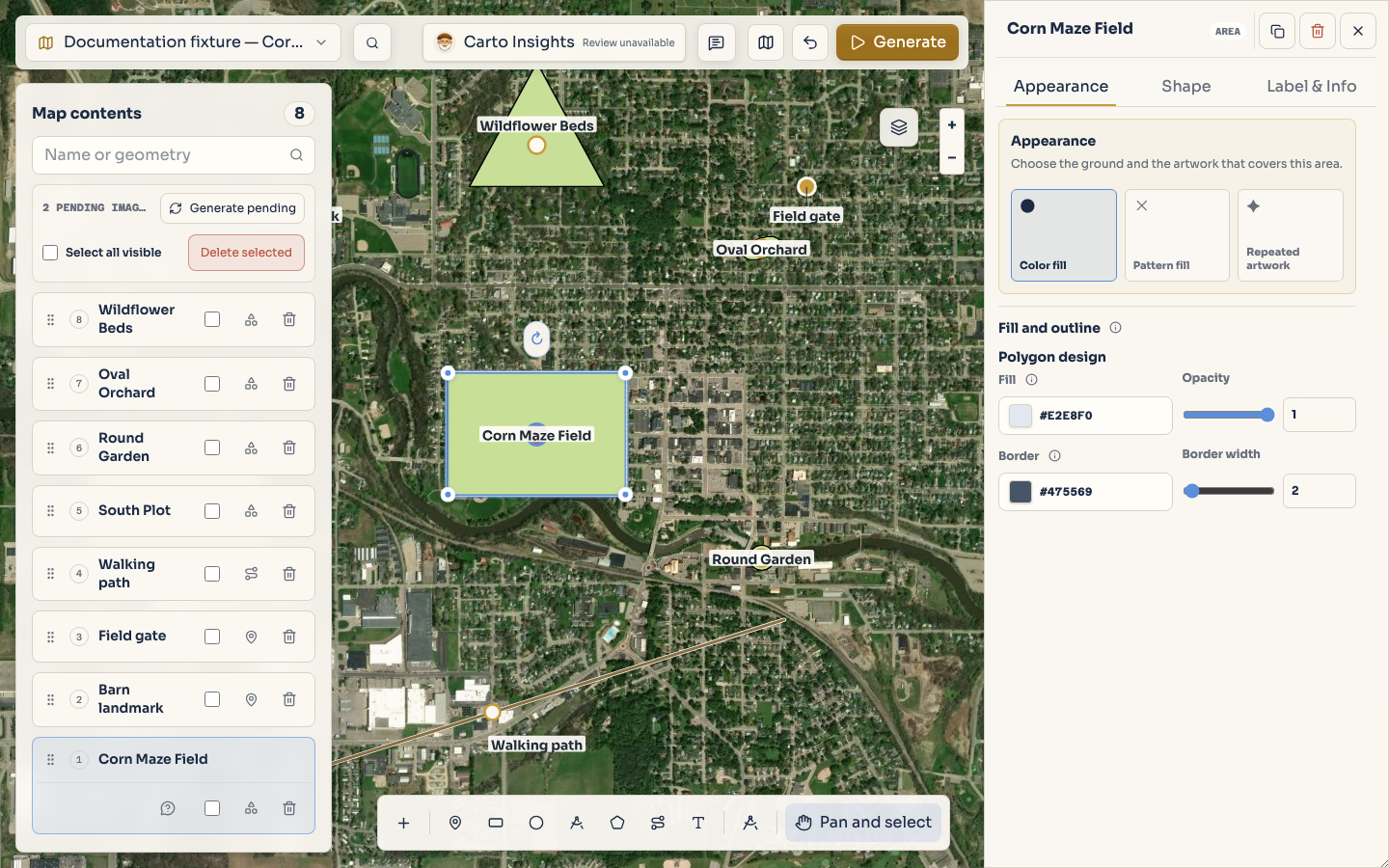
Start with the polygon that owns the field. It remains the authoritative boundary; imported lines
and structures are interpreted inside it and clipped to fit.
Map data: © Mapbox, © OpenStreetMap contributors, © Maxar, Improve this map
Project fixture: documentation-feature-guides
Open the importer
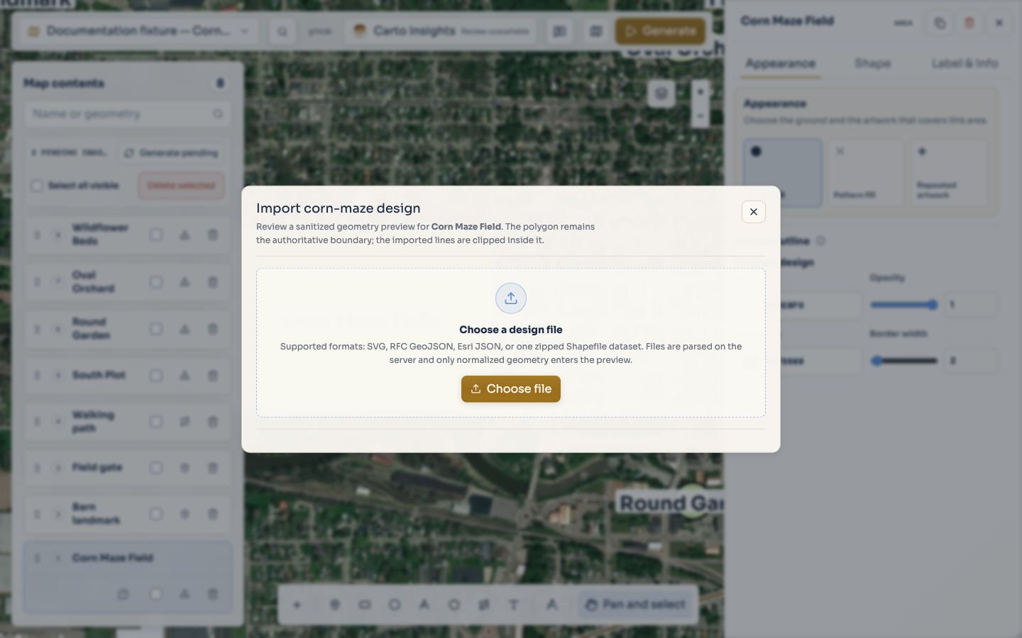
With a polygon selected, open the Import corn-maze design command. Choose Choose file and
select one supported input:
SVG
RFC GeoJSON
Esri JSON
one zipped Shapefile dataset
The zipped Shapefile option is a single dataset, not an arbitrary archive of unrelated files. The
server checks the content rather than trusting only a filename or browser MIME label.
Map data: © Mapbox, © OpenStreetMap contributors, © Maxar, Improve this map
Project fixture: documentation-feature-guides
Review the sanitized preview
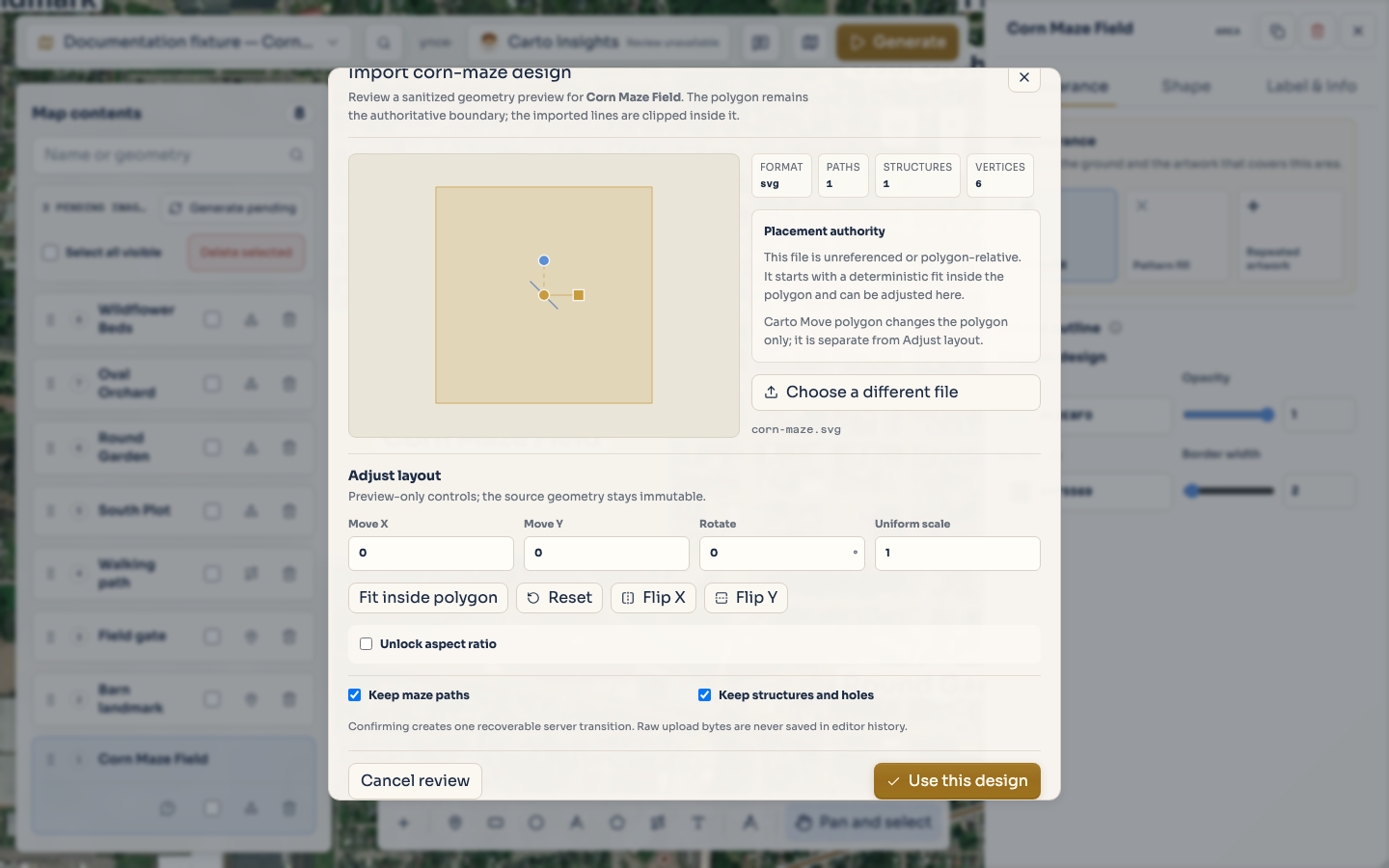
Cartowright parses the upload on the server and returns normalized geometry for review. The dialog
shows Paths, Structures, and Vertices counts, plus the coordinate interpretation.
Structures can include holes; the dialog does not show a separate hole count. The source bytes are
not retained in editor history. For an unreferenced or polygon-relative design, the preview starts
with a deterministic fit inside the selected polygon. A design with an explicit coordinate
reference starts at its mapped position.
Keep the polygon selected while reviewing. The imported paths are not a replacement for the
authoritative polygon, and a polygon move is a separate reviewed operation when the imported design
has a trusted geographic reference.
Adjust or interpret the layout
Choose Adjust layout when the preview needs a review-only correction. The available controls
include Move X, Move Y, Rotate, and Uniform scale. For unreferenced input, you can
also Fit inside polygon, Reset, Flip X, Flip Y, or unlock the aspect ratio with
separate stretch controls.
Use Keep maze paths to retain linework and Keep structures and holes to retain filled
structures and their holes. A trusted geographic design may offer Preview polygon move; that
operation proposes a translation, rotation, and positive uniform scale for review and does not move
the polygon automatically.
Confirm, replace, or remove
When the preview and interpretation are correct, choose Use this design for a new attachment or
Replace design when replacing an existing attachment.
Map data: © Mapbox, © OpenStreetMap contributors, © Maxar, Improve this map
Project fixture: documentation-feature-guides
Confirming creates one recoverable server transition. If the polygon already has an attachment, the
dialog makes clear that confirmation replaces it through one recoverable transition. To remove an
existing design, choose Remove current design. Use undo or redo when you need to restore or
reapply a confirmed change.
Do not treat the original filename, local path, or raw source bytes as project content. The useful
result is the normalized geometry and the confirmed attachment associated with the selected polygon.
For manual polygon creation before import, see Add artifacts to a map.